
Foundation Safety: Geotechnical Reports for Kenya Building Approval
In Kenya’s dynamic construction landscape, from Nairobi’s bustling urban centres to the coastal developments of Mombasa and the agricultural heartlands, the integrity of any structure begins deep beneath the surface. A comprehensive geotechnical investigation and its resulting report are not merely regulatory hurdles; they are foundational pillars ensuring the safety, longevity, and economic viability of a building. Skipping this critical engineering step exposes projects to significant risks, from unforeseen structural failures and costly remedial work to delays in county approvals and potential legal ramifications. Understanding the unique geological characteristics across Kenya and meticulously addressing them through expert geotechnical engineering is paramount for successful and compliant development.
Before you size footings or specify a slab, confirm what is under your site. See our geotechnical services, soil test cost guide, and foundation types in Kenya.
The Indispensable Role of Geotechnical Investigations in Kenya
Kenya’s diverse geology presents a unique set of challenges and opportunities for construction. From the expansive black cotton soils prevalent in parts of Nairobi, Kajiado, and Kisumu counties, to the stable murram and lateritic soils in central Kenya, and the complex coastal sands, silts, and coral formations, each site demands a tailored engineering approach. A geotechnical investigation systematically analyses these subsurface conditions, providing crucial data that informs foundation design, construction methodologies, and long-term structural stability.
Consider the black cotton soils, notorious for their high plasticity and volumetric changes with moisture content. Foundations built directly on these soils without proper mitigation measures are highly susceptible to differential settlement, leading to severe structural cracks, misaligned doors and windows, and ultimately, building collapse. Expert geotechnical reports for such sites in, for instance, Kitengela or Ruiru, would recommend strategies such as raft foundations, deep piles extending to stable strata, or soil stabilisation techniques like lime or cement treatment to mitigate expansion and shrinkage. Conversely, in areas with high water tables or sandy soils, such as along the Kenyan coast in Kilifi or Kwale, liquefaction potential during seismic events and corrosive groundwater conditions become primary concerns. Here, investigations would focus on determining the soil’s susceptibility to liquefaction and recommending appropriate foundation types, such as driven piles or deep foundations, often incorporating corrosion-resistant reinforcement to withstand the aggressive coastal environment.
The consequences of neglecting a thorough geotechnical investigation are multifaceted and severe. Structurally, inadequate foundations can lead to settlement issues manifesting as hairline cracks (less than 0.1 mm) escalating to significant shear cracks (exceeding 5 mm) within the superstructure, compromising the building’s integrity. Economically, remedial works for foundation failures can exceed 30% of the initial construction cost, not including the significant delays and reputational damage. From a compliance perspective, county planning authorities, including Nairobi City County, Mombasa County, and Kisumu County, strictly mandate these reports as part of the building plan approval process. Non-compliance leads to outright rejection of plans, protracted approval timelines, and potential stop orders during construction, all of which translate to substantial financial losses and project setbacks. Cadreatech’s detailed reports adhere strictly to relevant Kenyan building codes and engineering standards, ensuring that all recommendations are practical, compliant, and robustly engineered for the specific site conditions.
The deliverables of a comprehensive geotechnical report are extensive and critical for structural engineers. They typically include detailed borehole logs illustrating soil stratification, groundwater levels, and bedrock depths; laboratory test results such as Atterberg limits, unconfined compressive strength (UCS), California Bearing Ratio (CBR), and consolidation tests; and, most importantly, clear engineering recommendations. These recommendations specify the suitable foundation type (e.g., shallow pad footings, strip footings, rafts, piles), safe bearing capacity values (often expressed in kN/m² or MPa), anticipated settlement under design loads, and any necessary ground improvement or drainage measures. Without this precise, site-specific data, structural designs are based on assumptions, introducing unacceptable levels of risk.
Navigating the Geotechnical Report Process for County Approval
Securing a geotechnical report for building approval in Kenya involves a systematic, multi-stage process that combines desktop studies, field investigations, laboratory testing, and expert engineering analysis. Understanding this process is crucial for developers to manage project timelines and ensure seamless progression through county planning departments.
The typical process undertaken by Cadreatech, designed for thoroughness and compliance, follows these key steps:
- Initial Site Reconnaissance and Desktop Study: Our engineers conduct an initial site visit to assess topography, existing structures, vegetation, and visible geological features. Concurrently, a desktop study reviews available geological maps, historical land use, and any existing geotechnical data for the immediate vicinity. This initial phase helps in planning the scope of the detailed investigation.
- Investigation Planning and Methodology: Based on the reconnaissance, a detailed investigation plan is developed. This plan specifies the number, location, and depth of boreholes or test pits, considering the proposed building footprint, anticipated loads, and preliminary geological assessment. For multi-storey buildings or complex sites, deeper boreholes (e.g., 15-30 meters) are common, while smaller structures might require shallower test pits (e.g., 3-5 meters).
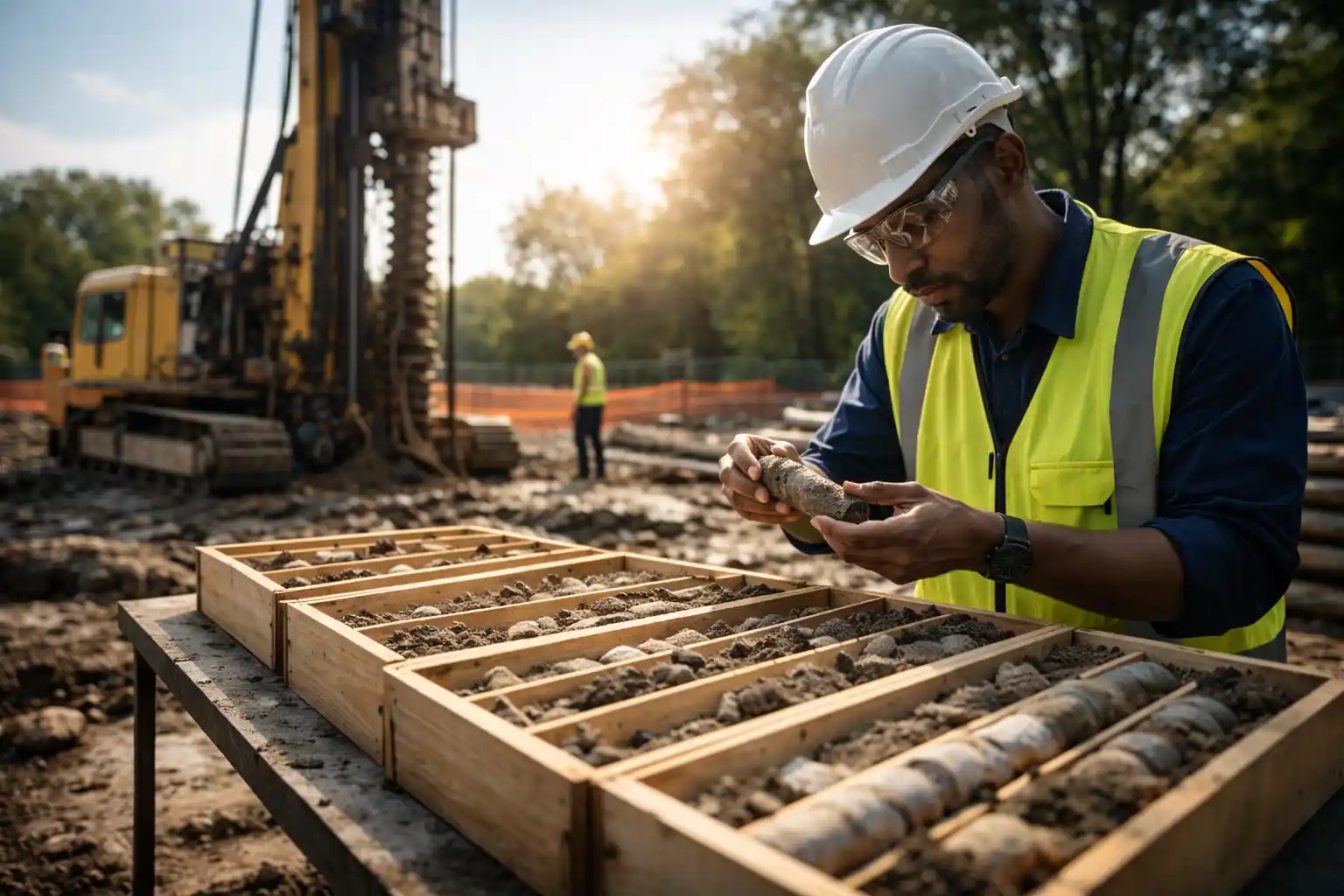
- Field Investigations (Boreholes and In-situ Testing): Geotechnical drilling rigs are mobilised to the site. Boreholes are advanced using appropriate drilling techniques (e.g., rotary wash drilling, auger drilling), and disturbed and undisturbed soil samples are systematically collected at specified depths. In-situ tests like the Standard Penetration Test (SPT) are performed within the boreholes to assess soil density and consistency, providing N-values critical for bearing capacity calculations. Dynamic Cone Penetrometer (DCP) tests may also be used for shallow pavement layers.
- Laboratory Testing and Analysis: Collected soil and rock samples are transported to accredited laboratories for comprehensive testing. This includes classification tests (particle size distribution, Atterberg limits), strength tests (unconfined compressive strength, direct shear, triaxial compression), and consolidation tests to determine settlement characteristics. Water samples may also be tested for chemical aggressiveness, particularly in coastal or industrial zones.
- Data Interpretation and Engineering Analysis: The field and laboratory data are meticulously analysed by our senior geotechnical engineers. This involves correlating test results with geological profiles, calculating bearing capacities, predicting settlement, assessing slope stability, and evaluating potential risks such as expansive soils, liquefaction, or rock stability issues.
- Report Generation and Recommendations: A comprehensive geotechnical report is prepared, typically including an executive summary, site description, methodology, detailed findings (borehole logs, test results), engineering analysis, and specific, actionable recommendations for foundation design, earthworks, and any necessary ground improvement measures. The report clearly states the safe bearing pressure for the proposed foundation system and provides estimates for total and differential settlement.
- Submission to County Authorities: The finalised geotechnical report, signed and stamped by a registered engineer, is submitted as a mandatory attachment to the building plan application. County planning departments, such as those in Nairobi, Kisumu, or Eldoret, scrutinise these reports to ensure compliance with local building regulations and to verify the safety and suitability of the proposed development.
The timeline for this process can vary significantly. A typical investigation and report generation for a medium-sized project might take between 3 to 6 weeks, depending on the site’s complexity, the number of boreholes required (e.g., 3-5 boreholes for a typical commercial building footprint), and laboratory turnaround times. Factors driving the scope, and consequently the investment, include the size and type of the proposed structure, the geological complexity of the site, the depth of investigation required, and the urgency of the project. A multi-storey commercial building on a geologically complex site in Mombasa, for instance, will require a more extensive and deeper investigation than a single-storey residential dwelling on stable murram in Machakos.
What Cadreatech Checks vs. What Buyers Often Miss:
| Cadreatech’s Comprehensive Checks | Common Omissions by Uninformed Buyers |
|---|---|
| Full Borehole Logs: Detailed geological profiles, water table, and in-situ test results (e.g., SPT N-values at 1.5m intervals). | Shallow Pit Tests Only: Relying on superficial observations or shallow test pits (less than 3m) that don’t reveal critical deeper strata. |
| Accredited Lab Tests: Comprehensive classification, strength (UCS, shear), and consolidation tests from a reputable, accredited laboratory. | Generic Soil Assumptions: Assuming “good soil” based on surface appearance or anecdotal evidence, skipping crucial lab analysis. |
| Site-Specific Recommendations: Tailored foundation type, bearing capacity, and settlement predictions for the exact proposed structure. | Standard Design Templates: Using generic foundation designs without specific soil parameters, leading to over- or under-design. |
| Risk Mitigation Strategies: Addressing potential issues like expansive soils, liquefaction, or high water tables with specific engineering solutions. | Ignoring Environmental Factors: Overlooking risks like coastal corrosion, seasonal flooding, or seismic activity in design considerations. |
| Compliance with Local Codes: Ensuring the report meets all requirements of relevant Kenyan building codes and county planning regulations. | Focus on Speed Over Quality: Opting for the cheapest, quickest “report” that lacks depth and may be rejected by authorities. |
The Geotechnical Investigation Process: From Site to Submission
A comprehensive geotechnical investigation is not merely a bureaucratic checkbox; it is a critical engineering exercise that underpins the safety and longevity of any structure. For building approval in Kenya, this process follows a rigorous methodology, ensuring that subsurface conditions are thoroughly understood and accounted for in the structural design. Cadreatech’s approach integrates advanced field techniques with detailed laboratory analysis, culminating in a report that provides actionable recommendations for foundation design and construction.
A Step-by-Step Technical Overview of the Geotechnical Investigation
The execution of a geotechnical investigation is a multi-stage process, meticulously planned and executed to gather accurate subsurface data. Each step is crucial for developing a reliable understanding of the site’s geological profile and its implications for structural stability:
- Site Reconnaissance and Desk Study: This initial phase involves a thorough review of existing geological maps, aerial photographs, and any available historical data for the site and its vicinity. A site visit is conducted by a senior geotechnical engineer to observe surface features, topography, drainage patterns, existing structures, and any visible signs of ground instability such as landslides or expansive soil behaviour (e.g., characteristic gilgai relief in black cotton areas). This helps in planning the scope of the intrusive investigation, including the optimal locations and depths for boreholes or test pits.
- Intrusive Ground Investigation: This is the core of the field work. For multi-storey structures or those with significant loads, rotary wash boring is typically employed to advance boreholes to specified depths, often exceeding 15 meters or reaching a competent bedrock stratum. Standard Penetration Tests (SPT) are conducted at regular intervals (e.g., every 1.5 meters or at changes in stratum) to determine the in-situ relative density of granular soils and consistency of cohesive soils, yielding valuable N-values. Disturbed and undisturbed soil samples are meticulously collected for laboratory analysis. In areas with shallow foundations or specific soil conditions like expansive clays in Kajiado, test pits may be excavated to allow for direct visual inspection and sampling of soil profiles up to 3-4 meters deep.
- In-Situ Testing: Beyond SPT, other in-situ tests can be deployed depending on project requirements. Cone Penetration Tests (CPT) provide continuous records of soil resistance and friction, useful for identifying soil layers and estimating shear strength parameters, particularly in soft clays or loose sands often found in coastal regions like Mombasa. Permeability tests (e.g., falling head or constant head tests) can be conducted in boreholes to assess groundwater flow characteristics, crucial for dewatering strategies in high water table areas.
- Laboratory Testing: Collected soil and rock samples are transported to a accredited geotechnical laboratory for a suite of analyses. Key tests include moisture content determination, Atterberg limits (Liquid Limit, Plastic Limit, Plasticity Index) to classify cohesive soils and assess their expansivity (critical for black cotton soils in Kisumu and Kajiado), sieve analysis and hydrometer tests for particle size distribution, and specific gravity. For strength parameters, unconsolidated undrained (UU) triaxial compression tests or direct shear tests are performed on cohesive soils, while unconfined compression tests are done on intact rock cores. Consolidation tests (oedometer tests) are conducted on compressible clays to predict long-term settlement under load.
- Geotechnical Data Analysis and Interpretation: The field and laboratory data are then rigorously analysed by experienced geotechnical engineers. This involves correlating N-values with soil properties, calculating allowable bearing pressures (e.g., using Terzaghi or Meyerhof methods), predicting total and differential settlements, and assessing potential risks like liquefaction (especially in seismic zones or loose saturated sands) or slope stability. For structures in Mombasa, the potential for chloride ingress and its impact on foundation durability is also factored into material recommendations.
- Report Generation and Recommendations: The culmination of the investigation is a comprehensive geotechnical report. This document typically includes an Executive Summary, Introduction, Site Description, Subsurface Conditions (detailed borehole logs, soil profiles), Laboratory Test Results, Engineering Analysis, and most critically, specific Recommendations. These recommendations cover the most suitable foundation type (e.g., shallow pad footings, raft foundations, piled foundations), allowable bearing pressures for different foundation types and depths, anticipated settlements, excavation considerations (e.g., shoring, dewatering), earthworks specifications, and mitigation measures for problematic soils. The report also addresses the implications for specific design elements such as retaining walls or basement construction, providing the necessary technical basis for structural design and county building approval.
This structured approach ensures that all relevant subsurface conditions are identified and addressed, providing the structural engineer with the essential parameters for a safe, economical, and compliant foundation design.
Key Factors Influencing Geotechnical Scope and County Requirements
The scope of a geotechnical investigation is never one-size-fits-all. It is meticulously tailored to the specific demands of a project, the unique characteristics of the site, and the prevailing regulatory environment. Understanding these drivers is crucial for project developers and ensures that the geotechnical report comprehensively addresses all potential challenges without unnecessary over-scoping.
Project-Specific and Site-Specific Scope Drivers
Several critical factors dictate the depth and breadth of a geotechnical investigation. These include:
- Type and Scale of Structure: A single-storey residential dwelling will require a less intensive investigation than a multi-storey commercial high-rise or a heavy industrial plant. Taller buildings or those with large footprints demand deeper boreholes and more extensive in-situ and laboratory testing to assess bearing capacity at significant depths and predict long-term settlement. For example, a 20-storey building in Nairobi’s CBD would necessitate boreholes extending 30-50 meters or more, far exceeding the typical 6-10 meters for a bungalow.
- Design Loads and Function: Structures with high concentrated loads, dynamic loads (e.g., machinery foundations, bridge piers), or those sensitive to settlement (e.g., hospitals, data centres) require more precise geotechnical parameters. This often translates to more closely spaced boreholes, additional in-situ tests like pressuremeter tests, and advanced laboratory tests such as cyclic triaxial tests.
- Site Geology and Geohazards: Sites with complex geology, such as highly variable soil profiles, karstic limestone, or areas prone to expansive clays (like the black cotton soils prevalent in parts of Kajiado and Kisumu), necessitate a more detailed investigation. Proximity to fault lines, steep slopes, or areas with a high water table (common in coastal Mombasa or near rivers/lakes) will trigger specific studies for seismic design, slope stability analysis, or dewatering requirements.
- Existing Infrastructure and Adjacent Structures: When constructing near existing buildings or critical infrastructure, the investigation must consider potential impacts such as ground vibrations from piling, settlement of adjacent structures due to excavation, or changes in groundwater regime. This often requires monitoring wells and careful assessment of influence zones.
- Access and Site Constraints: The accessibility of the site can influence the choice of drilling equipment and methodology. Restricted access might necessitate smaller, more portable drilling rigs, which can sometimes impact the achievable depth or speed of investigation.
- Urgency of Project: While not ideal, project timelines can sometimes influence the pace of investigation. However, accelerating a geotechnical study must never compromise its thoroughness, as this can lead to significant risks later on.
County-Specific Requirements and Geotechnical Considerations in Kenya
Different counties in Kenya present unique geotechnical challenges and, in some cases, specific regulatory nuances that influence the scope of required reports:
Nairobi County: As a rapidly urbanizing metropolitan area with high-rise developments, Nairobi often demands deep foundations (piles, rafts) due to significant structural loads and varying subsurface conditions. The geology can range from residual soils derived from volcanic rocks to highly weathered bedrock. Geotechnical reports here must address high bearing capacities, minimal differential settlement, and often, the impact of deep excavations on adjacent properties. The county planning department rigorously reviews geotechnical reports for compliance with structural stability standards for multi-storey buildings.
Mombasa County: The coastal environment introduces distinct challenges. High water tables, corrosive saline groundwater, loose sands, and the potential for liquefaction in seismic events are critical considerations. Geotechnical investigations in Mombasa must therefore emphasize groundwater analysis, chloride content testing, and dynamic analyses. Foundation designs often involve piled foundations to bypass weak superficial sands and mitigate corrosion risks through appropriate concrete mix designs and protection measures for steel reinforcement.
Kisumu County: Proximity to Lake Victoria means that many areas in Kisumu are underlain by highly plastic black cotton soils, known for their significant shrink-swell potential. Geotechnical reports here must explicitly address the expansivity of these clays, recommending specialized foundation solutions such as stiffened raft foundations, deep piles extending below the active zone, or ground improvement techniques. Careful attention to moisture control and drainage around structures is paramount.
Kajiado County: Similar to Kisumu, Kajiado County is extensively characterized by black cotton soils. Developments in this region require detailed assessment of soil expansivity. The geotechnical report will typically recommend specific measures to isolate foundations from seasonal moisture variations, such as deep trenching, chemical stabilization, or the use of non-expansive fill materials. The county’s development control officers are increasingly aware of these soil challenges and expect robust mitigation strategies in submitted designs.
An inadequate or superficial geotechnical report, driven by a desire to cut corners, carries severe consequences. These range from foundation failures manifesting as significant structural cracks (e.g., diagonal shear cracks, horizontal flexural cracks in beams), excessive and differential settlement leading to building tilting, and ultimately, structural collapse. Such failures necessitate costly and complex remedial works, extensive project delays, legal disputes, and potential revocation of building permits by county authorities, placing human safety at severe risk. Cadreatech ensures that every investigation is thorough and tailored, providing the robust technical foundation necessary for safe and compliant construction in Kenya.
Mitigating Risks and Ensuring Compliance with Geotechnical Reports in Kenya
The imperative for a comprehensive geotechnical report in Kenya extends far beyond a mere bureaucratic checkbox; it is a foundational pillar for structural integrity, long-term safety, and legal compliance. Skipping or inadequately performing this crucial step exposes a project to a cascade of risks, from immediate structural failures to protracted legal disputes and significant financial losses. Kenya’s diverse geological landscape, encompassing everything from expansive black cotton soils in parts of Nairobi and Kajiado to the complex coral limestone and high water tables of Mombasa, demands a tailored and rigorous approach to site investigation.
Without a professional geotechnical assessment, developers and homeowners risk designing foundations that are ill-suited to the underlying ground conditions. This can manifest as differential settlement, where parts of a structure sink more than others, leading to severe cracking in walls, floors, and even structural elements. Such cracks, ranging from hairline (< 0.1mm) to major (> 5mm) and indicative of structural distress, compromise the building’s safety and habitability. In extreme cases, inadequate foundation design based on assumptions rather than data can culminate in partial or total structural collapse, a tragic reality observed in some past incidents across Kenyan urban centres.
Compliance with local building codes and county planning regulations is another critical aspect. In Kenya, most county governments, including Nairobi City County, Mombasa County, and Kisumu County, mandate the submission of a geotechnical report as part of the building plan approval process for significant structures. This requirement is not arbitrary; it is a safeguard against unsafe construction practices and a mechanism to ensure public safety. For instance, in areas prone to seismic activity (though less common in Kenya, certain fault lines exist) or on slopes susceptible to landslides, the report provides essential data for designing resilient structures. The National Construction Authority (NCA) also emphasizes quality control and adherence to engineering standards, which a robust geotechnical report directly supports.
Consider the specific challenges presented by Kenya’s varied geology. In Nairobi’s expansive clay zones, such as areas along Thika Road or towards Ongata Rongai, foundations must be designed to counteract the volumetric changes of black cotton soil as it wets and dries. This often necessitates deep trench foundations, piled foundations, or reinforced raft slabs to bypass the active zone of seasonal moisture variation, typically extending 1.5 to 3.0 metres below ground level. A geotechnical report quantifies parameters like plasticity index, swelling potential, and moisture content, guiding engineers to specify appropriate foundation types and depths, thereby preventing future structural distress.
Along the coast, particularly in Mombasa and Kilifi, construction faces challenges from highly corrosive saline groundwater, weak coral limestone strata, and high water tables. Here, a geotechnical investigation must not only determine bearing capacity but also assess groundwater levels, chemical aggressiveness (e.g., sulphate content, pH) to inform concrete mix designs and reinforcement protection, and the presence of karst features or voids in the coral. Piled foundations driven to competent strata or raft foundations with extensive dewatering and corrosion protection measures are often required. The report will detail the allowable bearing pressure, estimated settlements under design loads, and recommendations for dewatering strategies during construction.
The consequences of circumventing professional geotechnical input extend to project delays and financial implications. County planning departments can issue stop orders if a building is found to be non-compliant or structurally unsound, potentially leading to costly demolition and reconstruction. Legal liability for developers, contractors, and even property owners in the event of structural failure is a severe risk. A properly executed geotechnical report serves as due diligence, providing a clear record of site conditions and design recommendations, thereby mitigating legal exposure and ensuring adherence to engineering best practices.
What Has Happened vs. What Should Happen
| What Has Happened (Without Geotechnical Report) | What Should Happen (With Cadreatech’s Geotechnical Report) |
|---|---|
| Assumed Ground Conditions: Foundations designed based on general knowledge or visual inspection, leading to inappropriate choices for expansive clays or weak strata. | Quantified Ground Conditions: Comprehensive soil investigation (boreholes, SPTs, lab tests) provides precise bearing capacity, settlement parameters, and soil classification. |
| Structural Distress: Differential settlement, severe cracking (e.g., diagonal cracks >3mm wide in load-bearing walls), tilting, and potential collapse due to inadequate foundation design. | Optimised Foundation Design: Recommendations for specific foundation types (e.g., deep piles, raft foundations, reinforced strip footings) and depths, ensuring long-term structural stability. |
| Project Delays & Cost Overruns: Stop orders from county authorities, need for costly remedial works, re-design, and reconstruction due to non-compliance or structural failure. | Streamlined Approval & Construction: Fulfilment of regulatory requirements, proactive identification of ground risks, preventing costly surprises and ensuring smooth project progression. |
| Legal & Safety Liabilities: Exposure to lawsuits from occupants or authorities, and compromised safety for building users due to a structurally unsound building. | Enhanced Safety & Compliance: Assurance that the building meets safety standards and regulatory mandates, protecting occupants and stakeholders from legal repercussions. |
Frequently Asked Questions
What makes a geotechnical report essential for building approval in Kenya?
A geotechnical report is fundamental for building approval in Kenya because it provides the critical scientific data about the subsurface conditions of a construction site. This data directly informs the safe and efficient design of foundations, ensuring the proposed structure will remain stable over its lifespan. Kenyan county regulations, such as those in Nairobi, Mombasa, and Kisumu, require this report to safeguard against structural failures, which can have devastating consequences. The report helps engineers understand soil bearing capacity, potential for settlement, presence of expansive soils (like black cotton), groundwater levels, and seismic considerations. Without this detailed understanding, foundation design would be based on assumptions, leading to potential structural distress, non-compliance with building codes, and significant safety risks for future occupants. It is a proactive measure to prevent costly rectifications and ensure the long-term integrity of the investment.
What factors influence the scope and complexity of a geotechnical investigation in Kenya?
The scope and complexity of a geotechnical investigation in Kenya are highly variable and depend on several key factors. Primarily, the proposed building’s size, height, and structural loads are critical; a multi-storey commercial high-rise will require a far more extensive investigation than a single-storey residential dwelling. Site access is another significant factor, as difficult terrain or congested urban areas can impact the logistics of drilling and sampling. The known or anticipated ground conditions also play a huge role; sites with suspected expansive clays, high water tables, or potential rock formations will necessitate deeper boreholes and more specialised testing. The urgency of the project can also influence the scope, as expedited timelines may require more resources for faster data collection and analysis. Furthermore, the specific requirements of the approving county authority and the client’s risk appetite for detailed analysis contribute to defining the investigation’s depth, the number of boreholes or test pits, and the range of laboratory tests performed, such as Atterberg limits, compaction tests, or shear strength tests.
How long does a typical geotechnical investigation and report preparation take?
The duration for a typical geotechnical investigation and the subsequent report preparation in Kenya varies significantly depending on the project’s complexity and site-specific conditions. Generally, for a standard residential or small commercial building on a relatively accessible site with straightforward geology, the entire process, from initial site visit to final report submission, can take approximately 3 to 6 weeks. This timeline typically breaks down into:
- Initial Consultation & Scope Definition: 1-3 days.
- Site Reconnaissance & Mobilisation: 3-5 days (including securing necessary permits).
- Field Investigation (Drilling/Test Pitting & Sampling): 5-10 days, depending on the number of boreholes/test pits and depths (e.g., 2-4 boreholes to 15m depth).
- Laboratory Testing: 7-14 days for analysis of soil and rock samples (e.g., moisture content, density, Atterberg limits, compaction, shear strength, consolidation).
- Data Analysis & Report Writing: 7-10 days for expert engineers to interpret findings, develop recommendations, and compile the comprehensive report, including foundation design parameters, settlement predictions, and construction considerations.
Factors such as adverse weather, difficult ground conditions (e.g., encountering hard rock unexpectedly), or delays in obtaining site access can extend these timelines. Cadreatech prioritises efficient project management to deliver timely and accurate reports.
What are the key components of a geotechnical report required for Kenyan building approvals?
A comprehensive geotechnical report for building approval in Kenya typically includes several critical sections, each providing specific data and recommendations essential for structural design. The core components are:
- Introduction: Project overview, location, and scope of investigation.
- Site Description: Topography, existing structures, drainage patterns, and geological context.
- Field Investigation: Detailed logs of boreholes, test pits, and in-situ tests (e.g., Standard Penetration Test – SPT N-values at 1.5m intervals), groundwater observations.
- Laboratory Testing: Results of tests on soil and rock samples (e.g., particle size distribution, Atterberg limits, moisture content, unit weight, shear strength parameters like cohesion and angle of internal friction, consolidation parameters).
- Subsurface Conditions: Interpretation of soil and rock stratigraphy, engineering properties of each layer, and groundwater regime.
- Engineering Analysis & Recommendations: This is the most crucial section, providing:
- Recommended allowable bearing capacity for various foundation types (e.g., strip, pad, raft, pile foundations).
- Estimated total and differential settlements under anticipated design loads.
- Recommendations for foundation depth and type based on structural requirements and soil conditions.
- Lateral earth pressure parameters for retaining wall design.
- Recommendations for ground improvement if necessary.
- Considerations for excavation, dewatering (if high water table), and construction materials.
- Assessment of potential risks (e.g., expansive soils, collapsible soils, slope stability).
- Conclusion: Summary of findings and key recommendations.
- Appendices: Borehole logs, test pit logs, laboratory test result sheets, site plans, and relevant photographs.
This detailed structure ensures that all pertinent information is available for structural engineers to design safe, compliant, and cost-effective foundations.
Key Takeaways
- A comprehensive geotechnical investigation is not merely a regulatory hurdle for building approval in Kenya; it is the foundational pillar of a safe, resilient, and economically sound construction project. Skipping this critical step, particularly in diverse geological zones like those found in Nairobi’s expansive clays or Mombasa’s coastal sands, exposes projects to unacceptable risks of differential settlement, structural failure, and significant financial repercussions later on.
- The insights derived from a detailed geotechnical report, encompassing borehole logs, Standard Penetration Test (SPT) N-values, and laboratory analysis of soil parameters (e.g., California Bearing Ratio, shear strength, consolidation characteristics), are indispensable for informing appropriate foundation design. This includes selecting between shallow foundations, piled foundations, or raft foundations, and specifying suitable bearing capacities and construction methodologies tailored to the specific site conditions.
- Engaging a qualified and registered geotechnical engineering firm like Cadreatech ensures that the site investigation adheres to local standards (e.g., Kenya Standard KS 2341:2010 for Geotechnical Investigations) and international best practices. This guarantees the integrity of data collection, accuracy of laboratory testing, and reliability of engineering recommendations, which are paramount for securing county approvals and ensuring long-term structural stability.
- Understanding the geological profile beneath your proposed structure—identifying problematic soil types such as black cotton soil with high shrink-swell potential, or areas prone to high water tables—allows for proactive design solutions. This mitigates future challenges, such as cracked foundations, water ingress, or even catastrophic collapse, thereby safeguarding both investment and human life.
- The scope and duration of a geotechnical investigation are directly influenced by factors such as the proposed building’s size and complexity, the geological variability of the site, access constraints, and the urgency of the project timeline. A multi-storey development on a challenging site will naturally require a more extensive array of boreholes, deeper penetration depths (e.g., to 30m or refusal), and a broader suite of laboratory tests compared to a single-storey residential unit.
- A robust geotechnical report provides the essential technical documentation required by county planning departments (e.g., Nairobi City County, Mombasa County) for building permit applications. It demonstrates due diligence, confirms the site’s suitability for the intended development, and is a non-negotiable component of the structural design submission package.
- While the initial investment in a thorough geotechnical report might seem like an added cost, it is a preventative measure that yields substantial savings by avoiding costly redesigns, remedial works, construction delays, and potential litigation stemming from unforeseen ground conditions. It is an investment in certainty and safety.
Ensure Your Project Stands on Solid Ground
Navigating the complexities of site investigations and regulatory compliance requires expert guidance. Cadreatech specialises in delivering precise, comprehensive geotechnical reports that meet Kenyan standards and ensure the long-term integrity of your construction projects.
Whether you are planning a residential development in Kisumu, a commercial high-rise in Nairobi, or an industrial facility in Mombasa, our team of experienced engineers is equipped to provide the detailed analysis and actionable recommendations you need for successful building approval and construction.
Contact Cadreatech today to discuss your project requirements and receive a tailored quotation for your geotechnical engineering needs. Partner with us for unparalleled expertise and peace of mind.
Contact Us:
Phone: +254 719 532 233
Email: info@Cadreatech.com
Website: Cadreatech.com
