
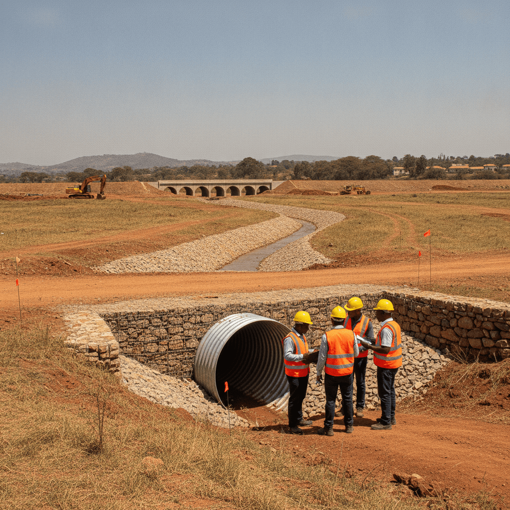
Riparian land is among the most misunderstood constraints in Kenyan development. Title deeds rarely show seasonal channels that appear every rainy season; survey beacons on flat plots do not reveal that NEMA and the Water Resources Authority (WRA) enforce buffers along watercourses regardless of whether the stream is dry in August. Developers who pour foundations before riparian verification face stop orders, demolition orders, and lender covenant breaches. Cadreatech engineers riparian setbacks into layout design — rotating blocks, shrinking footprints, and redesigning drainage — rather than treating buffers as a surveyor’s afterthought.
Land near rivers touches NEMA, WRA, and hydrology together. Read riparian construction & NEMA, flood assessment, and WRA permits.
How to spot seasonal channels on title vs ground
A clean title search does not prove absence of riparian reserves. Seasonal channels — often called “blue lines” on planning maps — may run through plots sold as prime development land. Topographic survey and wet-season site walks reveal gradients, silt lines, and vegetation patterns that desk research misses. Drone photography after rains shows flow paths across ostensibly flat agricultural parcels in Nairobi, Kiambu, and Kajiado.
Surveyors should flag provisional setback lines on feasibility sketches shared with architects before option purchases expire. Developers who commission only boundary beacons without contour survey routinely discover riparian constraints after design fees are sunk.
Coastal riparian and estuarine plots add mangrove protection themes — treat shoreline developments as high-sensitivity regardless of advertised acreage.
Cadreatech recommends riparian screening before land purchase on any plot within five hundred metres of known rivers, including Nairobi River tributaries, Athi plains drainage, and coastal creeks. The NEMA EIA requirement checker includes riparian sensitivity flags — use them alongside physical survey. If ground evidence contradicts seller representations, renegotiate or walk away before legal completion.
Encroachment into riparian reserves discovered during construction may trigger demolition orders and criminal liability exposure — not merely administrative fines. The cost of setback survey at feasibility is negligible compared with structural demolition after half a basement is cast.
Detailed engineering options appear in our riparian construction guide. Early checker screening prevents apartment blocks being designed with basements encroaching into reserves.
- Topographic survey with contour intervals showing low points
- Wet-season site visit — March to May and October to December patterns
- Historical aerial imagery and county planning overlays
- Neighbour interviews — long-term residents know where water runs
- NEMA and county wetland maps where published
NEMA and WRA interfaces
NEMA administers environmental licensing under EMCA, including riparian protection provisions in subsidiary regulations. The Water Resources Authority manages water resource permits, abstractions, and structures in watercourses. A project affecting a riparian reserve may need both NEMA licensing with setback compliance and WRA approval for any bridge, culvert, or drainage structure that alters flow.
Developers sometimes obtain county building approval while ignoring federal riparian rules — counties do not waive NEMA jurisdiction. Integrated compliance tracks federal environmental licensing, WRA where structures touch watercourses, and county physical planning together. Cadreatech maps interfaces at feasibility so consultants are not sequentially discovering regulators mid-design.
Crossing a watercourse with a culvert or bridge triggers structural and hydraulic design review. WRA may require submission of crossing details even when NEMA licensing addresses broader project impacts. Budget both regulators in programme and consultant scope from the start.
Riparian setbacks are not negotiable with your architect’s preference for a basement car park. They are statutory buffers enforced with stop orders.
Case pattern — Nairobi River buffer apartment (summary)
A representative Nairobi pattern: a developer acquires a riverside plot in an inner-city renewal zone, proposes an eight-storey apartment with basement parking, and submits county plans. Topographic survey reveals the building footprint encroaches six metres into a riparian reserve mapped after the original title issuance. NEMA screening directs full EIA; complaint committee review follows given urban sensitivity.
Mitigation requires rotating the tower axis, eliminating basement on the river side, and installing stormwater attenuation disconnected from the riparian zone. Programme cost: twelve weeks of redesign plus four months EIA. A lender with environmental covenants withholds drawdown until licence issues with EMP conditions enforceable during construction — silt fencing, concrete wash water control, no spoil dumping in reserve.
The project survived because layout rotation happened before piling — not after. That is the difference riparian intelligence at land purchase makes.
Inner-city renewal projects along Nairobi River corridors face additional stakeholder scrutiny from regeneration agencies and community groups. Public participation is not a box-ticking exercise on these sites — it shapes licence conditions on construction hours, haul routes, and riverbank rehabilitation contributions.
Structural options for riparian-constrained sites include pile caps above setback lines, suspended floors avoiding excavation in reserves, and boardwalk setbacks for landscaping rather than built form. Civil engineers and architects must iterate these options before basement depth is fixed in sales brochures.
When layout rotation saves the project
Not every riparian constraint kills development. Setback compliance often allows a viable scheme if addressed at sketch design. Rotating a block to keep habitable rooms outside the buffer, shifting parking to the landward side, using podium decks instead of basements near channels, and stepping building heights away from the riparian edge preserve unit count while respecting reserves.
Cadreatech architects and civil engineers iterate layouts against survey-defined buffers before detailed design money is spent. Building approval and environmental compliance programmes run county and NEMA drawings from one model so reviewers see consistent setbacks.
Utility corridors — power lines, fibre routes, and water mains — sometimes constrain layout rotation options as much as riparian buffers. Feasibility should stack all linear constraints on one site plan before unit mix is marketed to investors.
Where buffers consume too much area for the intended density, the honest feasibility answer is reduce units or change land — not hope NEMA grants an exception without formal process.
Lender technical due diligence on riparian-adjacent collateral increasingly requests independent survey certification of setbacks before valuation sign-off. Developers who cannot demonstrate buffer compliance face loan amount reductions or covenant delays even when county plans are approved.
Floodplain modelling may be required where rivers like Athi and seasonal tributaries in Kajiado experience flash flooding. EIA hydrology chapters should reference return periods and finished floor levels — coordination between civil drainage design and architectural levels prevents contradictory submissions.
Frequently asked questions
What is the riparian setback distance in Kenya?
Setback distances depend on watercourse classification, regulations, and site-specific NEMA/WRA determinations — not a single universal metre value. Survey and regulator consultation establish the applicable buffer.
Do wetlands follow the same rules as rivers?
Wetlands are environmentally sensitive areas under EMCA. Development in or near wetlands typically requires full EIA and strict buffers. Treat wetland edges as non-buildable unless NEMA confirms otherwise.
Is hydrology baseline always required?
For riparian and floodplain projects, wet-season hydrology and drainage baseline is standard EIA scope. Dry-season-only surveys are routinely rejected.
Will lenders finance riparian-adjacent projects?
Institutional lenders require environmental licence and clear setback compliance before drawdown. Encroachment risk is a credit issue — resolve before financial close.
Can riparian land be excised from title?
Excision and planning processes are separate from environmental licensing. Even with clean title geometry, riparian reserves may still apply to watercourses on or adjacent to the plot.
Building near a river, wetland, or seasonal channel? Cadreatech surveys riparian constraints and redesigns layouts before costly stop orders. Request a consultation or call +254 719 532 233.
